I didn't think there was going to be a Part Two to my post about building the world of the Seven Seas. I thought the world was pretty much built. I just had to fill it in with cultures and peoples and cities and such, which I'd do as I went along writing the stories themselves.
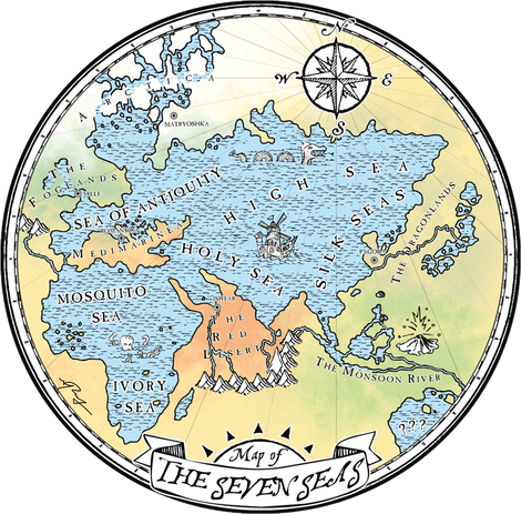
But there was always something that bugged me about the original Seven Seas map of the Merry Mariner world:
But there was always something that bugged me about the original Seven Seas map of the Merry Mariner world:
Where's "North America" and "South America"? It's clear that it's an inverted map of our world, but why only just the half?
I never really had a good answer for this, but I didn't think it was all that important until some real, actual kids saw the map and asked me this precise question. In that moment, I realized two things: first, kids are smarter than I am, and second, the fact that it was only half a map was distracting. The map needed another hemisphere.
Easier said than done.
The world I'd made was already pretty well laid out - I knew where the rough equivalent to nearly all the real-world countries and cultures were situated, I had my own, personal, fully fleshed-out world map with names of regions, cities, towns, coasts, bays, rivers, mountains, each with their own peoples, cultures, resources and wildlife. All that would have to be re-configured. I had the Seven Seas! Adding the "Americas" would make it Nine Seas, and I'm sorry, but that just doesn't have the same ring to it. Moreover, adding this new hemisphere would require a lot of time, a lot of work, and a lot of energy which could be spent elsewhere - like actually writing stories, perhaps. Is that really worth it?
The final and possibly most important reason why I didn't want to add the "Americas" went back to why I never included them in the first place...and that's because, well, it's because I'm from the Americas. I am an American. The Merry Mariner is supposed to be a series of stories about exploring wild, exotic, far-off lands, not the Chicago suburbs or Route 66. Yes, the Americas also includes the Yukon, the Caribbean and Central and South America, but if I included those, I'd have to also include a Merry Mariner equivalent to the US of A. These stories are written in large part so that I can travel to faraway places; they're about adventure out there. I'm already here! If I wanted to travel in the USA, I'd just walk out my front door. Where's the fantasy in that?
But then...I started mulling. And once I get mulling, it's not easy to get me un-mulled.
I began to daydream. If I included the "America Seas" in my world map, I could include an Amazon-like rain forest with ancient, towering stone temple-towers and cities of gold overgrown with man-eating vines and quicksand traps. I might explore the Caribbean, with floating coconut pirate fortresses, mysterious Easter Island-ish giant stone people and poisonous lagoon sharks. I could even visit a fantastical USA that never existed - I could explore an alternate-universe Wild West with lawless towns built into the sides of humungous saguaro cacti, gold miners blasting through rivers with dynamite and New Orleans-esque gambling cities sinking into willowy swamps.
Maybe that wouldn't be so bad after all.
It would settle the "where's America?" question once and for all, and I'd have a full new hemisphere to explore if I wished. Maybe I didn't want to write a story that took place there - that's fine, too. It would simply be a richer, fuller world, informing the backgrounds of stories to coming, and allowing anyone who set eyes on the full world map to let their imagination roam free.
So I did it.
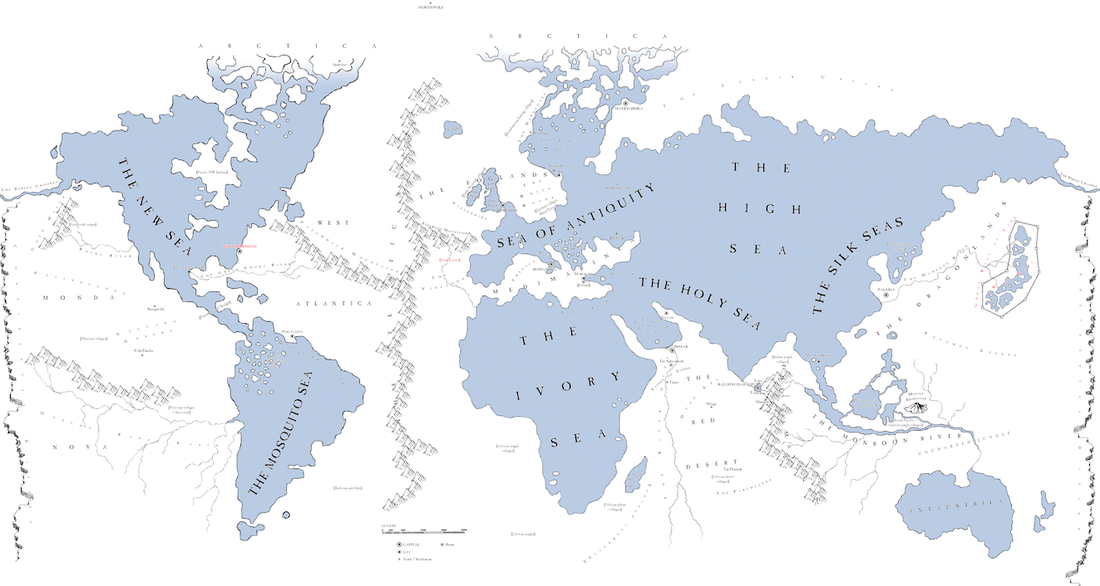
First, I updated my personal, detailed map of the Seven Seas - which I only use for my reference, not for public eyes (but you can have a peek at it if you like).
I got to pull apart the world I'd created and reorganize it. It was like spring cleaning. I moved the Mosquito Sea to "South America" (it was always named after the Mosquito Coast in Central America anyway), gave "North America" the obvious New Sea title (get it? New World? Obviously you get it), and began figuring out how the regions would break down. Luckily, "Central America" broke the Monda Nova (New World? Huh? Huh??) landmass into eastern and western halves, so it was no stretch to place the vast, raw wilderness of the Saguaro Desert and the cultured plains and farmlands of West Atlantica on the east (so named for being on the western side of the Atlantic Range which separates the "USA" from "Europe"). I needed a way for the Dragonlands not to crash into Monda Nova in the middle of the "Pacific", so I created the Continental Divide - a humungous, impassible gorge running from north to south, which cuts the cultures off from one another.
The only thing I really lost, when the dust settled, was Australia as the mysterious "Seventh Sea," an idea I'd dreamed up a while back, that it was an unexplored wilderness, just a rumored sea, perhaps even some kind of afterlife-like paradise. The previous rationale was that the Silk Seas might be counted as one sea or two, and if counted as one, there remained a Seventh to be found. But after adding the New Sea, moving the Mosquito Sea and giving the Ivory Sea to all of "Africa," I was already counting the Silk Seas as one if I wanted there to be Seven Seas in all. So that was that. Perhaps I can recycle this mystery paradise idea somewhere else. And as for Australia, although it's not yet marked above, it's been renamed Antaustrila, and downgraded from a Sea to a mere Giant Lake...but I have some great ideas in store for it.
Yes, it took me a lot of time and energy. But it was also really fun.
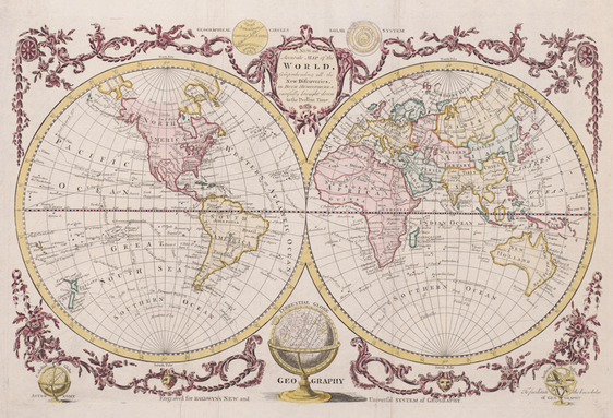
Next up: to design the simplified, more artistically creative version for the site and future publication. I looked at several old world map designs, and settled on this one, which I like quite a lot:
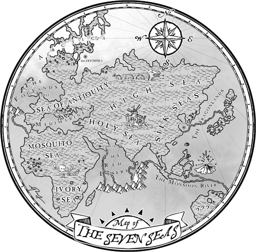
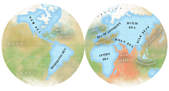
I tried a variety of styles and ideas, trying at the same time to take the opportunity to improve upon the old design. One of the weaknesses of the original world map is that it's not high enough contrast. While it's obvious that black and white drawings should employ light and shadow to make images pop, I didn't think to apply it to color art, as well - but it does. See for yourself:
Notice how the water and land are basically the same shade of grey, making the overall image muddy. This muddy contrast affects clarity in the color image, even if it's not as obvious. So this is one thing I aimed to fix.
Early on in my experimenting, I stumbled on a style that I really liked:
Early on in my experimenting, I stumbled on a style that I really liked:
Clean, pretty, stylish, high-contrast, unique...what more could you ask for? I find it really lovely.
Sadly, it simply won't do.
This style, with the gradients and color washes, is much more indicative of graphic design from the 1940s and 50s. Adventure serials, Indiana Jones and the like. At least, that's what it makes me think of. The Merry Mariner series is firmly turn of the century - late 1800s to early 1900s, or even older if the need arises. I want the series to feel timeless, not "modern" (even if we're talking about 1950s modern). Lovely as this style is, it just doesn't jive with the fat black Hergé lines and 1900s aesthetic of the rest of the Merry Mariner art. I'll have to save it for some future project (or you can steal it!).
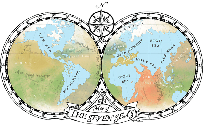
In the end, this is what I settled upon:
I have to say, I'm quite fond of it. I'm glad I took the time to expand the world. And, I solved the contrast problem.
The map is far from finished--what you see now is simply the grand overview, but it's very much a work in progress. My personal, much more detailed map - the one with cities, towns, etc - has just doubled in size and requires filling in. I need names for the "New Orleans" and "New York / Boston" cities, as well as a nice and detailed history and culture. What does the USA look like in this alternate universe? Is it a land of Paul Bunyans and Johnny Appleseeds? What's south-east of the Mosquito Sea, or north of the Great Smoky River? What's the relationship between Indians and settlers in this world, and should they even be called Indians if there's no India?
I've got my work cut out for me. And that suits me just fine.
Check out the World page if you want to get tantalizing descriptions of the new and improved Seven Seas!
I've got my work cut out for me. And that suits me just fine.
Check out the World page if you want to get tantalizing descriptions of the new and improved Seven Seas!
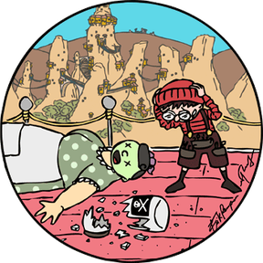
In other news, today I published the first two pages of Waldo and the Spider's Sting! Check it out below:
And guess what? The first page is a map! That's always great fun. You might have guessed by now that I like maps.
Waldo and the Spider's Sting will update right here on the site with a new page every Monday, Wednesday and Friday. As with all Merry Mariner stories, it's fully illustrated and guarantees a fantastic good time. And stay tuned until the end - this story is jam-packed with appendices and extras.
'til next time,
M. Ray

 RSS Feed
